Residential Drone Photos
Give Buyers a Wider View of the Home.
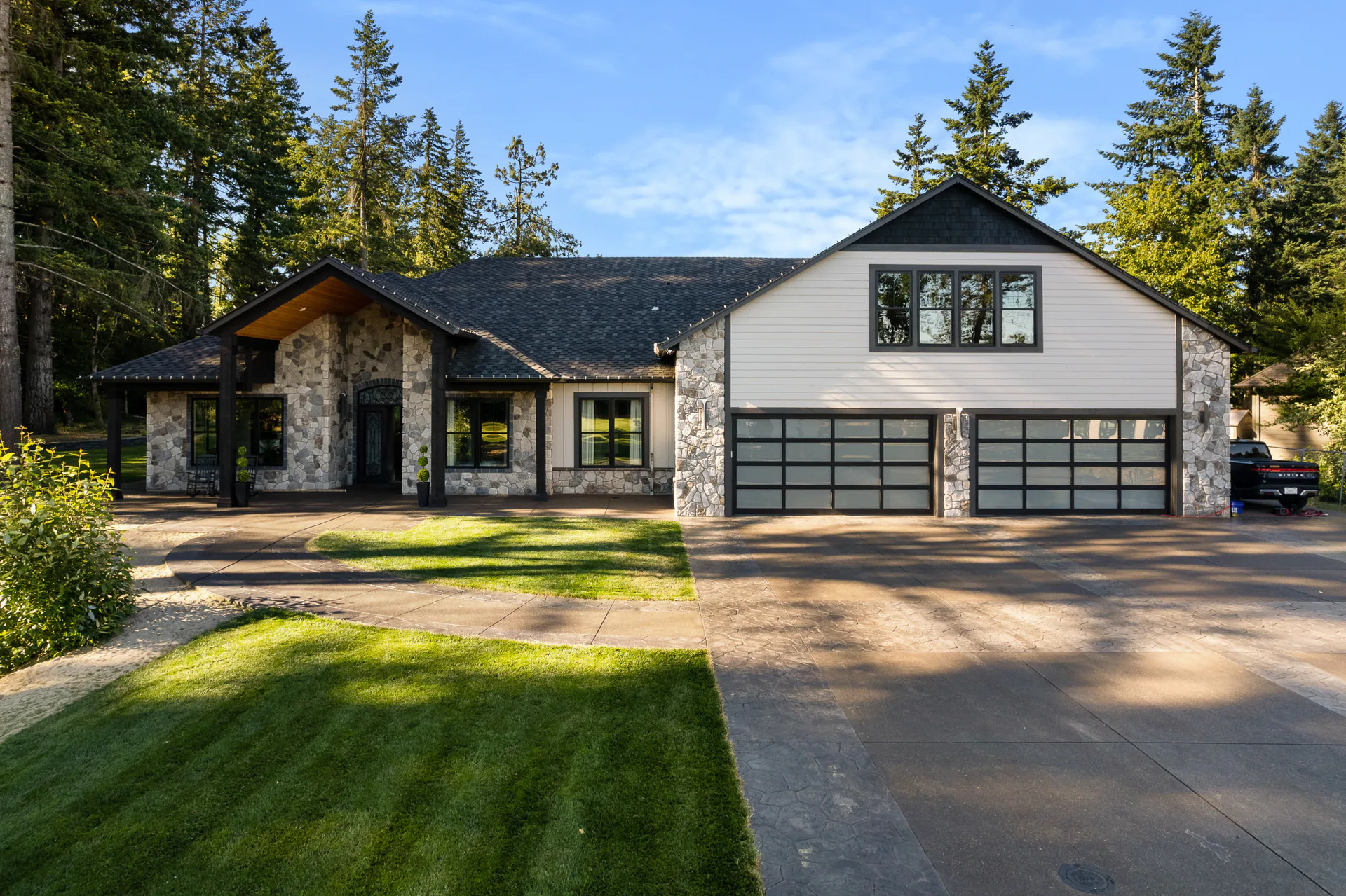
A useful aerial photograph can show the home, outdoor spaces and surroundings together. Choose the viewpoints that help buyers understand your listing, whether it sits on a small lot or a larger property.
The view that explains the home
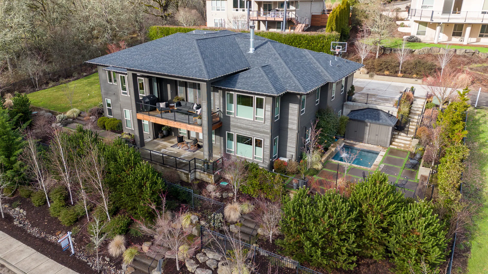
See the Property at Different Heights
A closer elevated view can show the exterior clearly. Looking down can connect the house, outdoor spaces and nearby streets. The useful height depends on what you want the photograph to explain.
Explore different viewpoints from our work across several properties.
Explore Full Galleries
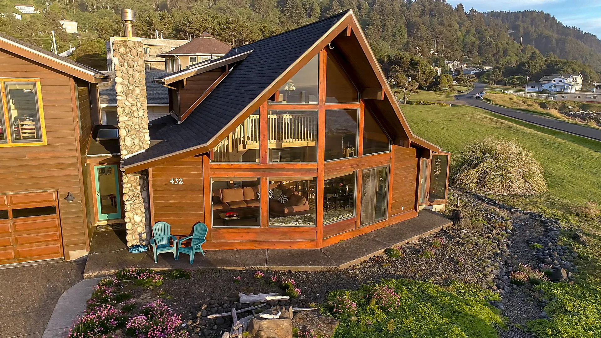
Start with the listing’s useful details
What the Photographs Should Show
Which exterior angle is hard to show from the ground? Tell us about the home, outdoor areas, access and views that matter to your listing. Aerial photographs can bring those relationships into the same frame.
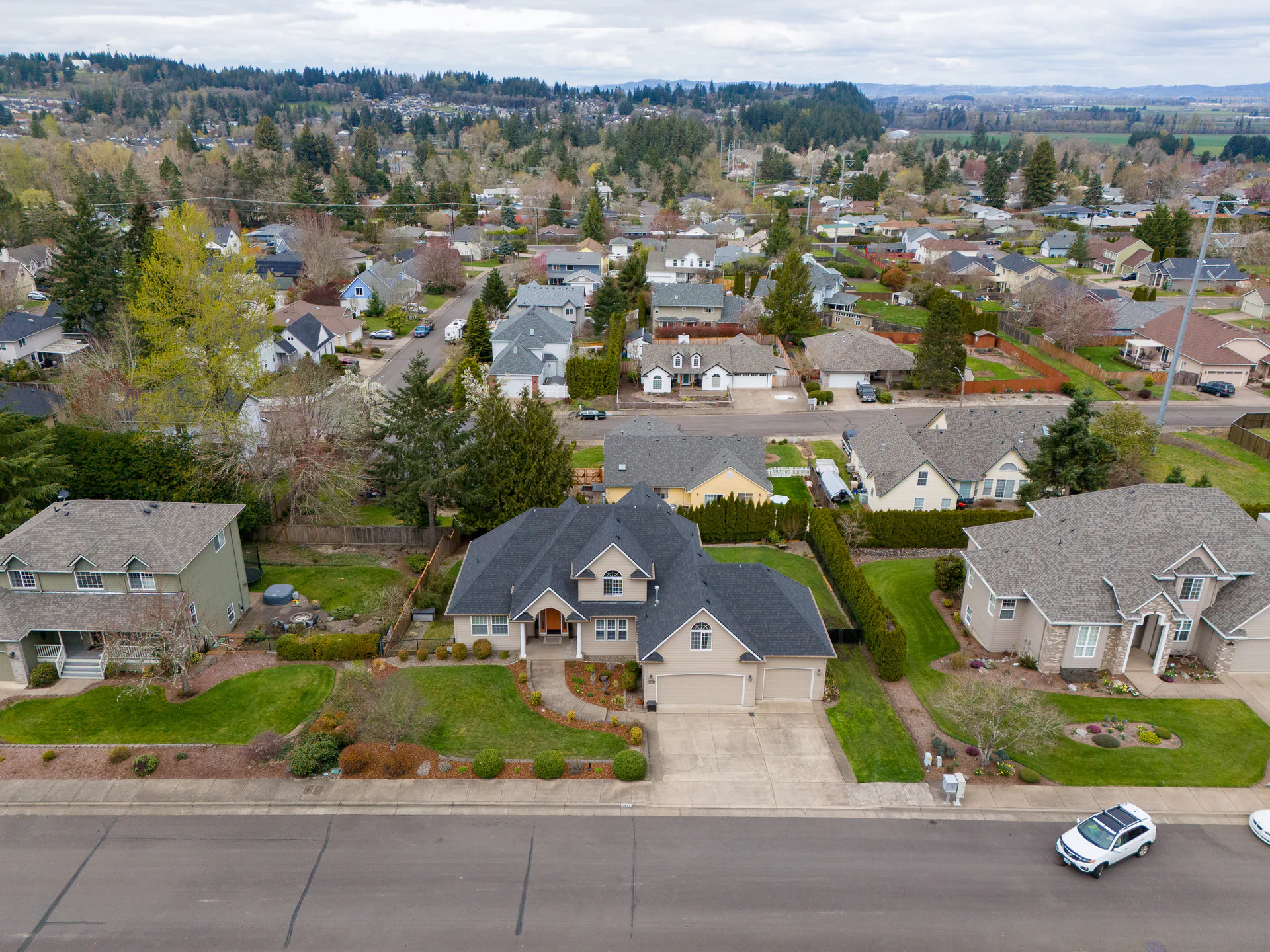
This aerial view takes in a home, its curving drive and the trees and open land around it. It shows what’s visible, not a survey or a record of legal property boundaries.
Drone photographs complement room and ground-level photographs. Plan the views around what buyers need to understand rather than choosing height for its own sake.
Plan the Room and Exterior Photographs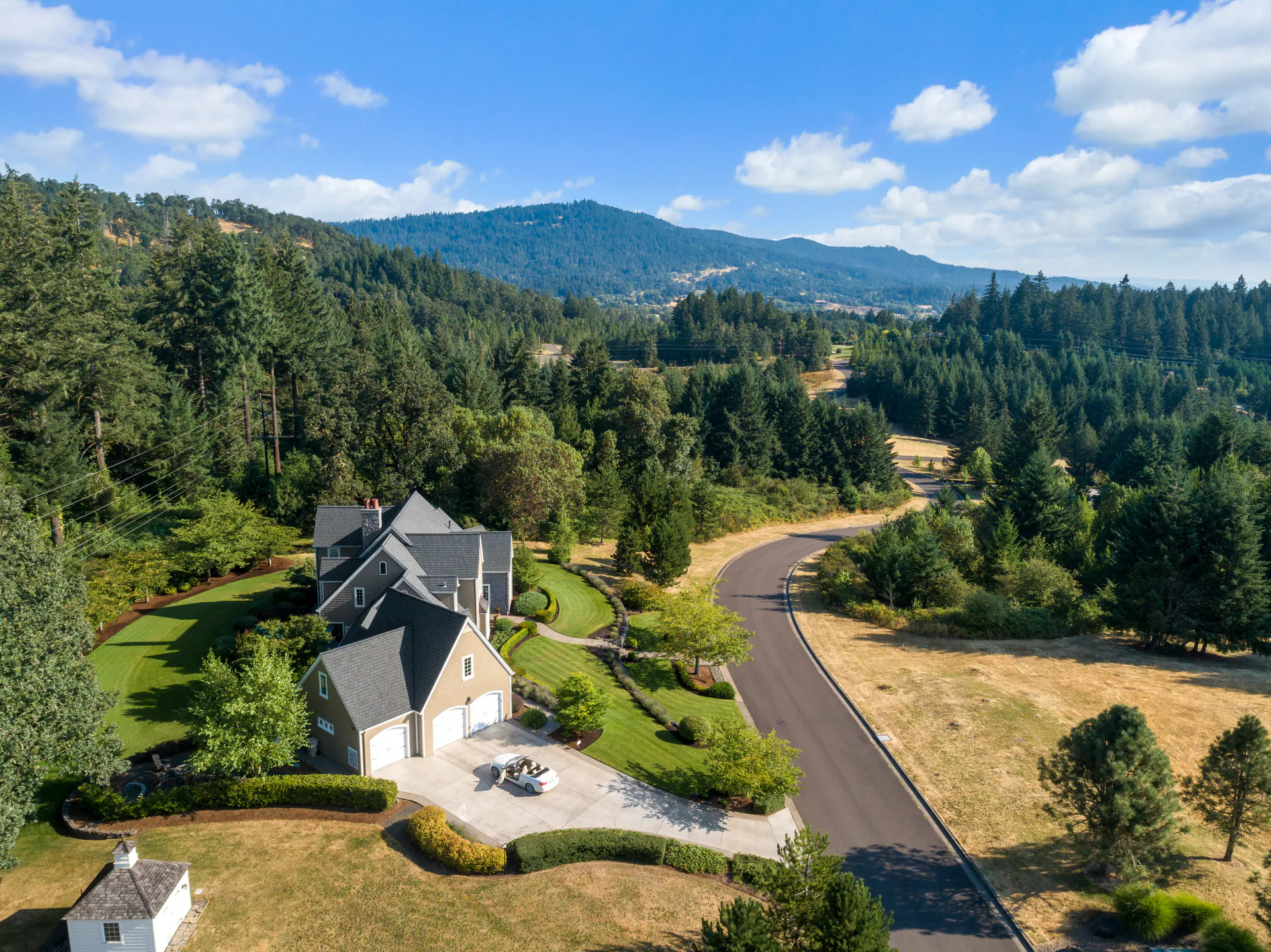
Before the appointment
What Should We Know About the Property?
Share the areas you want to show and discuss access, conditions and timing with us. We’ll help you plan useful coverage for the property.
Identify the Views
Share the address, acreage and exterior features that matter. Tell us about any important view or access area you want us to consider.
Plan Access
Let us know about gates, obstacles and who can arrange access. We’ll plan suitable viewpoints around the property.
Plan for the Conditions
We work around Pacific Northwest weather and confirm the plan with you.
Pricing and Coverage Details
Prices are in USD. Residential booking shows your full total. The $89 drone-photo add-on is for Basic. If you’re considering Plus, choose Premium instead: it’s Plus with drone photos. The Premium example covers homes up to 2,500 sq ft; larger homes use other price bands, and beyond 6,000 sq ft needs a custom quote.
The Basic drone-photo add-on uses the same general coverage approach as the aerial stills in Premium and Elite. Your image allowance depends on the package, property size and drone coverage. We’ll help you choose suitable views and any additional photos.
Acreage upgrades add broader coverage and more images. More than 20 acres uses a time-and-materials quote. Share the acreage, buildings, access and views you want to show. Up to one acre needs no upgrade; exactly five acres falls in 1–5, and exactly twenty in 5–20. Any boundary overlays are illustrative, rather than a property survey.
Your full total includes the base order, compatible additions, any travel charges and applicable fees or taxes. For motion, drone video comes with the Elite package.
Residential price examples
What Drone Coverage Costs
Premium brings photography, a floor plan and drone photography together. Add aerial stills to Basic, or plan broader coverage for a larger property.
Add aerial stills to Basic
Drone Photographs
+$89
An add-on for the Basic package. Premium and Elite already include drone photos.
- Aerial still photographs
- Views and image allowance planned with you
Package example
Premium Residential
$289
For homes up to 2,500 sq ft.
- Residential photography
- Included floor plan
- Drone photography
Additional acreage coverage
1–5 Acre Upgrade
+$59
An addition to an eligible residential package or compatible drone-photo order.
- Broader property coverage
- Additional images
- Help selecting coverage for your acreage
Additional acreage coverage
5–20 Acre Upgrade
+$99
An addition to an eligible residential package or compatible drone-photo order.
- Broader property coverage
- Additional images
- Help selecting coverage for your acreage
For a larger property, tell us which buildings, outdoor areas and views you want buyers to see.
Bring the home and setting together
Ready to Add Aerial Photographs?
Choose Premium or Elite in residential booking, or add drone photos to Basic. You can also ask us about your property’s coverage. Tell us what the aerial photographs need to explain so we can help you plan the views.
Considering motion too? Compare Residential drone photographs and video.